Update Our ticketing, donations, and membership sales portal is down for scheduled maintenance on the afternoon of 4/11.
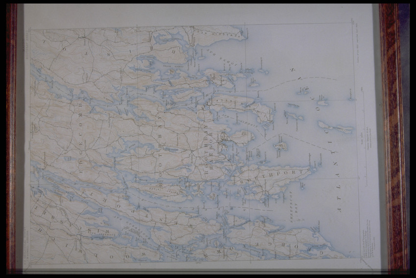
Topographical map of Boothbay Harbor from an 1891 survey. Includes: Woolwich, Wiscasset, Georgetown, Edgecomb, Bristol, and Southport.
topographic maps
paper (fiber product)
Unidentified Paper
MAP
Printed: ""U.S. GEOLOGICAL SURVEY./J.W. POWELL, DIRECTOR./Edition of Oct. 1893/reprinted April 1905.""
Original to Castle Tucker (Wiscasset, Me.),
Unknown
21.75 x 17.75 x 1 (HxWxD) (inches)
Gift of Miss Jane S. Tucker
1998.135
Maine (United States)
Historic New England is committed to implementing reparative language description for existing collections and creating respectful and inclusive language description for new collections. If you encounter language in Historic England's Collections Access Portal that is harmful or offensive, or you find materials that would benefit from a content warning, please contact [email protected].
Sign up to our newsletter for our latest news and events