Update Our ticketing, donations, and membership sales portal is down for scheduled maintenance on the afternoon of 4/11.
1912
GUSN-191054
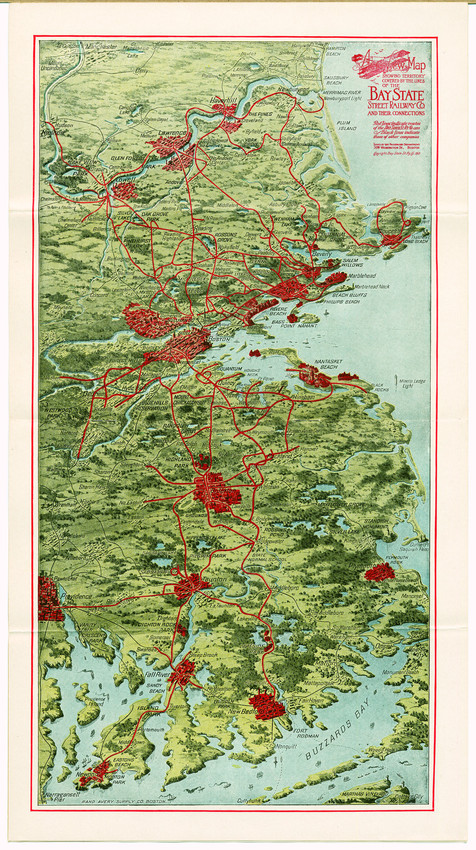
The map has red illustrations indicating the size of cities and towns on the routes.
advertising
business (commercial function)
transportation
trolley cars
maps
1 map : color
EP001
Ephemera collection
EP001.01.117.01.02.024
Boston (Suffolk county, Massachusetts)
Bay State Street Railway Company (Publisher)
maps
Washington Street (Boston, Mass.)
W.H.Bunting, The Camera's Coast: Historic Images of Ship and Shore in New England (Boston: Historic New England, 2006) pg. 42.
Original in Ephemera - Transportation [?]
Item
Historic New England is committed to implementing reparative language description for existing collections and creating respectful and inclusive language description for new collections. If you encounter language in Historic England's Collections Access Portal that is harmful or offensive, or you find materials that would benefit from a content warning, please contact [email protected].
Sign up to our newsletter for our latest news and events