Update Our ticketing, donations, and membership sales portal is down for scheduled maintenance on the afternoon of 4/11.
ca. 1863
Vertical File 4A, Drawer 2
GUSN-203783
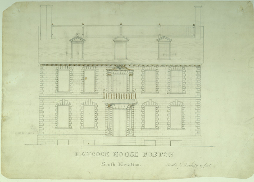
Architect John Hubbard Sturgis drew this measured drawing of the south elevation of the John Hancock House on Beacon Hill, Boston, Massachusetts, that was demolished in 1863.
historic houses
dwellings
measured drawings
exterior elevations
DigitalID 000153
AccessID 336
Other identifier HNEDID-000153
1 measured exterior elevation : black ink, watercolor, and graphite emendations on wove paper ; 14 3/4 x 20 inches
AR001
General architectural and cartographic collection
1965
AR001.USMA.0250.004.001
Museum Purchase
Beacon Hill (Boston, Suffolk county, Massachusetts) [neighborhood]
Boston (Suffolk county, Massachusetts)
Sturgis, John Hubbard, 1834-1888 (Draftsman)
measured drawings
exterior elevations
Hancock, John, 1737-1793
Component
Vertical File 4A, Drawer 2
Historic New England is committed to implementing reparative language description for existing collections and creating respectful and inclusive language description for new collections. If you encounter language in Historic England's Collections Access Portal that is harmful or offensive, or you find materials that would benefit from a content warning, please contact [email protected].
Sign up to our newsletter for our latest news and events