Update Our ticketing, donations, and membership sales portal is down for scheduled maintenance on the afternoon of 4/11.
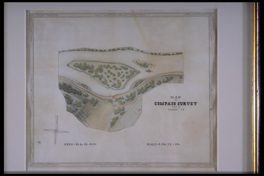
Framed compass survey map by RHT Jr. (III); overhead drawing and watercolor of area w/ trees, water, roads, and sectioned off land; lower left corner w/ 4 pointed compass symbol and inscription "AREA-91 A. 1R. 34P." In right lower corner, "SCALE--5CH. TO 1 IN." Mounted in 1 1/2" wood and gilt frame.
topographic surveys
paper (fiber product)
watercolor (paint)
Unidentified Paper
Watercolor
MAP
Inked in middle of map: ""R.H. TUCKER, J.R./ MADE BY CLASS '79""
Original to Castle Tucker (Wiscasset, Me.),
Tucker, R. H. (Richard Hawley), 1859-1952 (Maker)
18.5 x 20.5 (HxW) (inches)
Gift of Miss Jane S. Tucker
1998.636
Historic New England is committed to implementing reparative language description for existing collections and creating respectful and inclusive language description for new collections. If you encounter language in Historic England's Collections Access Portal that is harmful or offensive, or you find materials that would benefit from a content warning, please contact [email protected].
Sign up to our newsletter for our latest news and events