Update Our ticketing, donations, and membership sales portal is down for scheduled maintenance on the afternoon of 4/11.
undated
GUSN-289277
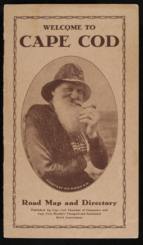
A road map and directory of Cape Cod intended for use by automobile drivers. The cover features an oval image of a fisherman smoking a pipe.
tourism
roadways
driving
transportation maps
1 folded map
MS028
Nina Heald Webber Cape Cod Canal collection
MS028.01.010.004
Cape Cod (Barnstable county, Massachusetts) [peninsula]
Cape Cod Canal (Massachusetts) [canal]
Cape Cod Chamber of Commerce
transportation maps
Item
Historic New England is committed to implementing reparative language description for existing collections and creating respectful and inclusive language description for new collections. If you encounter language in Historic England's Collections Access Portal that is harmful or offensive, or you find materials that would benefit from a content warning, please contact [email protected].
Sign up to our newsletter for our latest news and events