Update Our ticketing, donations, and membership sales portal is down for scheduled maintenance on the afternoon of 4/11.
undated
GUSN-291613
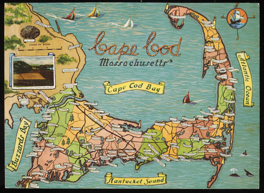
1 color postcard of a tourist map of Cape Cod illustrated with cities and towns and surrounding seas, c. 1958.
tourist maps
postcards
DigitalID 002106
AccessID 4072
Other identifier HNEDID-002106
1 color postcard of a tourist map of Cape Cod; 6.5" x 9"
MS028
Nina Heald Webber Cape Cod Canal collection
2013
MS028.04.028.019
c. 1958
Cape Cod (Barnstable county, Massachusetts) [peninsula]
Curt Teich and Co. (Publisher)
postcards
Item
Historic New England is committed to implementing reparative language description for existing collections and creating respectful and inclusive language description for new collections. If you encounter language in Historic England's Collections Access Portal that is harmful or offensive, or you find materials that would benefit from a content warning, please contact [email protected].
Sign up to our newsletter for our latest news and events