Update Our ticketing, donations, and membership sales portal is down for scheduled maintenance on the afternoon of 4/11.
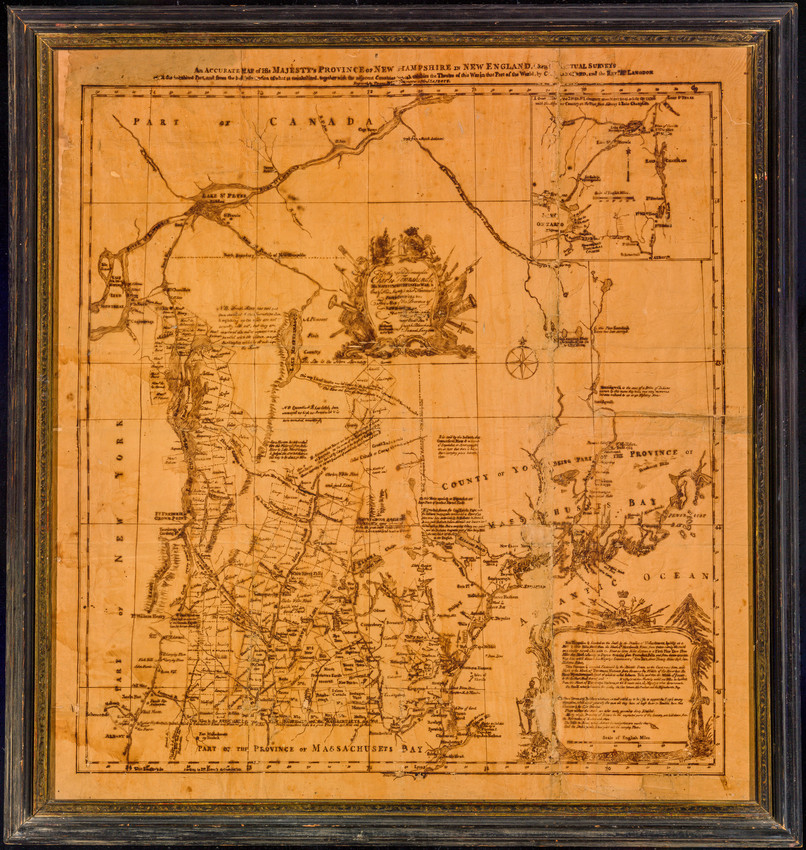
Survey map of province of New Hampshire and northern edge of Massachusetts Bay Colony; Canada to the north. Framed.
maps
prints (visual works)
engraving (printing process)
paper (fiber product)
Cartograph
Map
Map
Printed: 1)(top) Engraved by Thomas__ __ tographer to HIS MAJESTY. 2) (center) To the right Honourable Charles Townshend/ HIS MAJESTY'S SECRETARY at WAR.../ Joseph Blanchard/ Samuel Langdon/ Portsmouth/ New Hampshire/ 22 Oct 1762(?) 3)(lower right) New Hampshire is bounded on the south by the Province of Massachusetts...
Townshend, Charles
Blanchard, Joseph, Mr.
Langdon, Samuel, Mr. (Maker)
Portsmouth, NH, USA, (?); Portsmouth, NH, USA, Rockingham Cty
34 1/2 x 32 (HxW) (inches)
Anonymous Gift
1938.274
1762 (Possibly)
New Hampshire (United States)
Historic New England is committed to implementing reparative language description for existing collections and creating respectful and inclusive language description for new collections. If you encounter language in Historic England's Collections Access Portal that is harmful or offensive, or you find materials that would benefit from a content warning, please contact [email protected].
Sign up to our newsletter for our latest news and events